Most of Australia can expect a hotter-than-average December, with temperatures being forced up by both regional climate patterns and a global upwards trend.
Temperatures were forecast to peak between 29C and 34C on Thursday, the first day of summer, in all states bar Victoria and Tasmania. Melbourne and Hobart could look forward to highs of 21C and 24C.
Queensland would be the worst affected, with Friday expected to be Brisbane’s hottest December day in 15 years peaking at 38C.
Severe heatwave conditions forecast in southern and central parts of the state were forecast to continue into early next week. The Bureau of Meteorology (BoM) warned residents to be mindful of the impact of heat stress.
There were also low- to severe-intensity heatwave conditions across northern Western Australia and the Top End of the Northern Territory.
Almost all of Australia could expect drier-than-average conditions in December, with a 70 to 80% chance of below-average rainfall across most of the eastern part of the country.
Above-average temperatures were forecast for days and nights across eastern and northern Australia for the entire summer through to February.
The higher-than-usual pressures in the short term were the result of a climate driver known as the Southern Annular Mode, typically associated with reduced rainfall and higher temperatures.
It was forcing wind systems further north than normal, holding monsoon weather at bay while moving air far across the continent.
“It acts a bit like a wall that blocks the influence of the tropical wet season,” said Andrew Watkins, the acting head of climate monitoring and prediction at BoM.
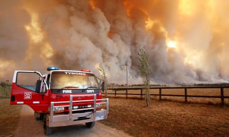
The combination has resulted in severe fire danger for parts of NSW, Queensland, WA and ACT, and that risk would persist with the drier and hotter conditions over the summer.
The second-wettest winter on record had encouraged grass growth, prompting concerns about fast-running grass fires, particularly on the urban fringe, said Watkins.
The Bushfire and Natural Hazards Cooperative Research Centre said the fire risk was predominately in grassland areas of Victoria and NSW.
Cyclone season is not set to begin in earnest until January, but Watkins said an average to above-average season – typically 11 cyclones – was forecast. Last season there were only three, a record low, because of an “exceptionally strong” El Niño.
“We don’t want people to be complacent because not much happened last year ... It was not typical by any means.”
BoM’s seasonal outlook for December to February also warned that “Australian climate patterns were being influenced by the long-term increasing trend in global air and ocean temperatures”.
This year has already been declared the hottest ever recorded.
Watkins said it was difficult to break down the impact of climate change on weather in Australia compared with local patterns and drivers.
“The reality is climate change is playing a role in all of our weather and climate these days,” he said.
